


Detail from “Spanish North America, Southern Part,” (John Thomson, A New General Atlas [Edinburgh: John Thomson and Co., 1817].)
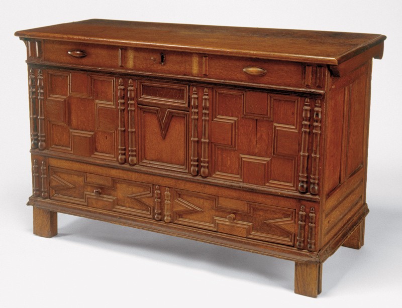
Chest attributed to the Symonds shops, Salem, Massachusetts, 1701. Oak, maple, mahogany, and red cedar (by microanalysis). H. 31 1/4", W. 47 3/4", D. 20 5/8". (Courtesy, Concord Museum, Concord, MA, gift of Russell Kettell; photo, David Bohl.) The dated panel is mahogany.
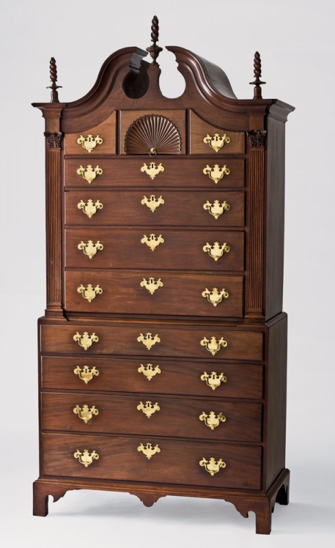
Chest-on-chest possibly by Abraham Watson (1712–1790), Salem, Massachusetts, 1760–1770. Mahogany with white pine. H. 90", W. 44", D. 23". (Courtesy, Peabody Essex Museum Collection, R1120, bequest of Sarah Cheever, 1908.) Watson may have made this chest for Judge Nathaniel Ropes in exchange for unfinished mahogany.
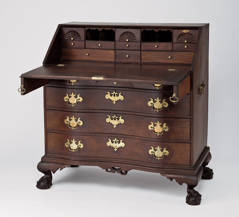
Desk attributed to William King (b. 1754), Salem, Massachusetts, ca. 1776. Mahogany with white pine and brass. H. 43 1/2", W. 40 1/4", D. 21 1/2". (Courtesy, Peabody Essex Museum Collection, 101792, bequest of Sarah Cheever, 1908.)
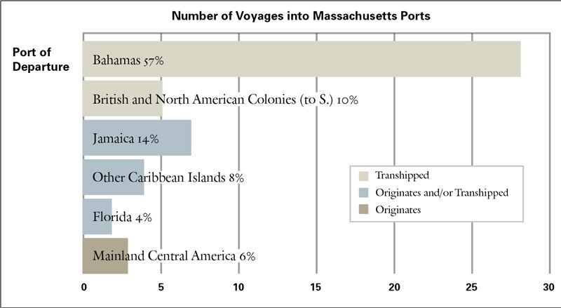
Mahogany Entering Massachusetts Ports, 1752–1765. (Derived from “Abstracts of English Shipping Records,” Peabody Essex Museum.)
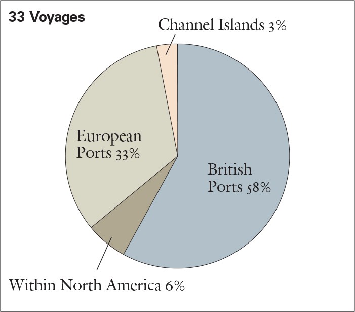
Mahogany Clearing Massachusetts Ports, 1752–1765. (Derived from “Abstracts of English Shipping Records,” Peabody Essex Museum.)
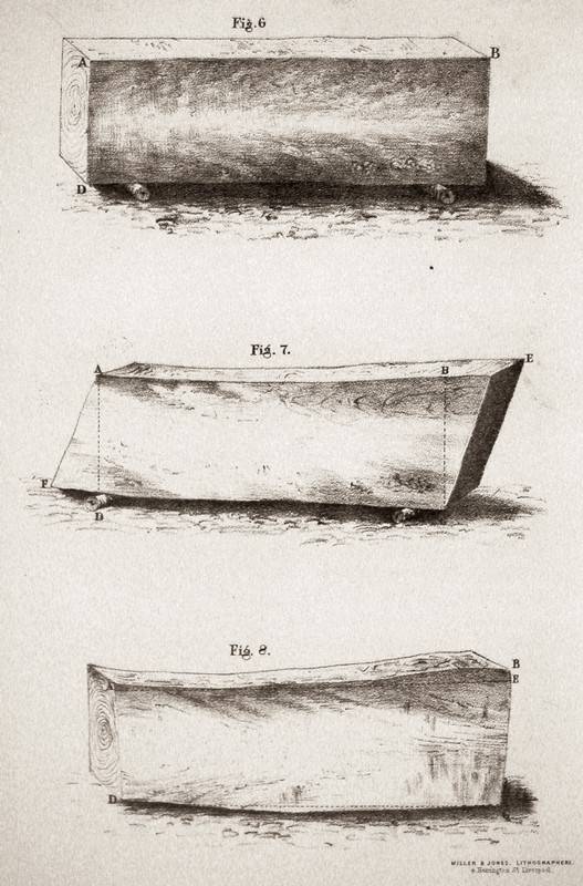
Assessing the contents of a squared log. (Chaloner and Fleming, The Mahogany Tree [Liverpool: Rockliff and Son, 1850].)

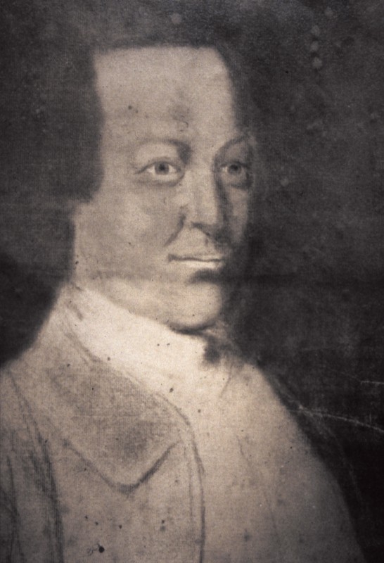
Portrait of Aaron Lopez, unidentified artist. Oil on metal. Dimensions not recorded. (Courtesy, American Jewish Historical Society, New York, NY and Newton Centre, MA.)
Portrait of James Card, unknown artist, medium, and dimensions. (Ex-collection, Rhode Island Historical Society. Current location unknown.)
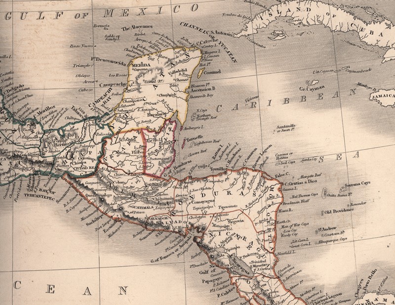
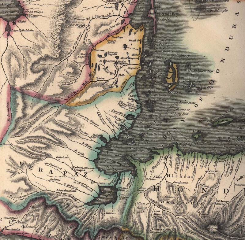
Detail from “Mexico and Central States,” (Sydney Hall, A New General Atlas [London: Longman, Brown, Green and Longmans, 1857].)
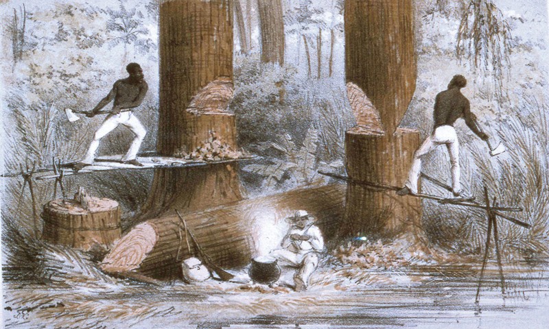
J. McGahey, Felling Mahogany, Liverpool, England, ca. 1850. Lithograph. 6" x 9". (Courtesy, American Antiquarian Society.)
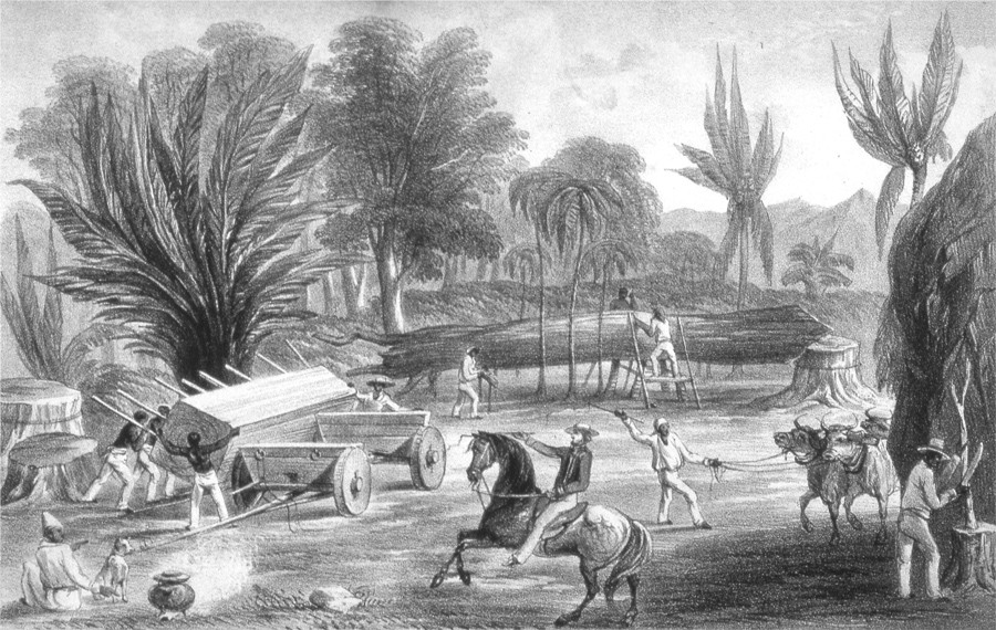
Day and Son, Cutting and Trucking Mahogany in Honduras, Liverpool, England, 1850. (Chaloner and Fleming, The Mahogany Tree [Liverpool: Rockliff and Son, 1850].)
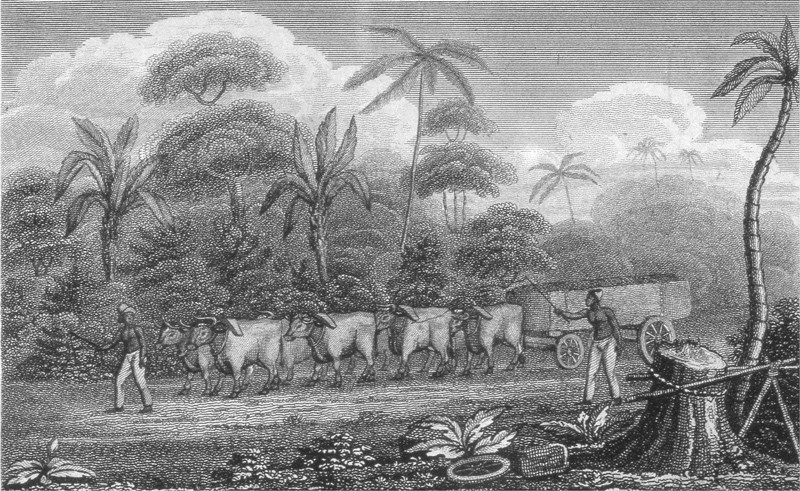
Manner of Trucking Mahogany in Honduras, attributed to William B. Annin and George G. Smith after Andrew Bayntun, Boston, 1826. Engraving on paper. 4" x 7". (Honduras Almanack, 1826.)
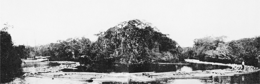
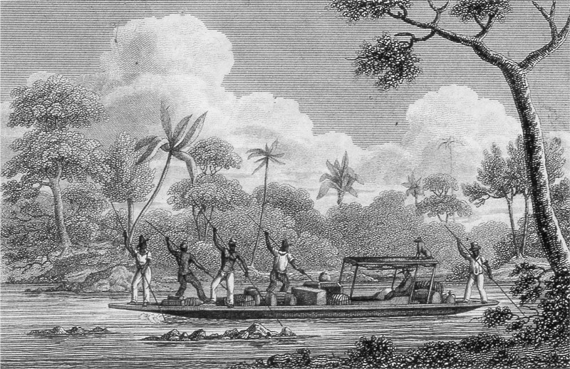
“Rafting mahogany logs down New River.” (Standley and Record, The Forest and Flora of British Honduras [Chicago: Field Museum of Natural History, 1936], pl. 4. ID #B78614.)
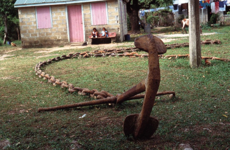
Boom chain of undetermined date retrieved from the lower Belize River at the village of Burrell Boom. (Photo, Daniel Finamore.)
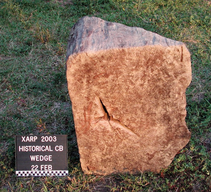
Wedge-shaped end of a squared mahogany log, used to prevent stacks of logs from rolling. (Photo, Daniel Finamore.) The author found this log in the Sibun River near Cedar Bank.
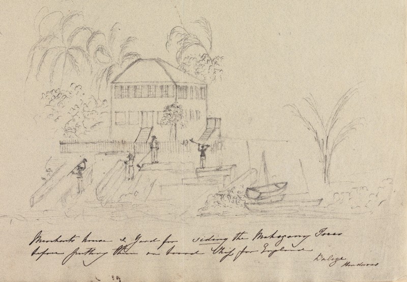
Charles Dashwood, Merchant’s House and Yard for Siding the Mahogany Trees before Putting Them on Board Ship for England, Belize, ca. 1830. Graphite and ink on paper. 10 1/4" x 8 1/4". (Courtesy, Yale Center for British Art, Paul Mellon Collection.)
Mode of Travelling of the Woodcutters in the British Settlement of Honduras, attributed to William B. Annin and George G. Smith after Andrew Bayntun, Boston, 1828. Engraving on paper. 4" x 7". (Honduras Almanack, 1828.)

Tracing of a portion of David Lamb’s A Map of that part of Yucatan in the Bay of Honduras allotted to Great Britain for the cutting of Logwood. Ink and watercolor on paper, 1787. The map, which is oriented with north at the bottom, shows Matthias Gale’s Caledonia and the woodcutting claim of Robert Francis O’Brien. Caledonia was located on a wedge-shaped piece of elevated land, flanked on two sides by swamp and on the third by the New River. Densely forested today, it is several kilometers from the modern town of Caledonia. The site was carefully investigated through surface collection within a grid of meter-square units, yielding a large assemblage of eighteenth- and early-nineteenth-century ceramics, glassware, pipe fragments, and gunflints. O’Brien’s site was discovered thirty-four kilometers south of the New River mouth, in a recently cut sugar cane field on a low ridge running parallel to the east bank. The site contained a thin scatter of artifacts ranging from buff-bodied slipwares of the early eighteenth century to hand-painted pearlwares of the 1810s and 1820s. The site appears to have been occupied longer than most of the others.
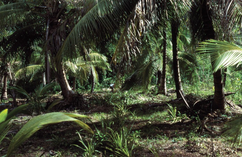
Site of Matthias Gale’s woodcutting claim Caledonia. (Photo, Daniel Finamore.)
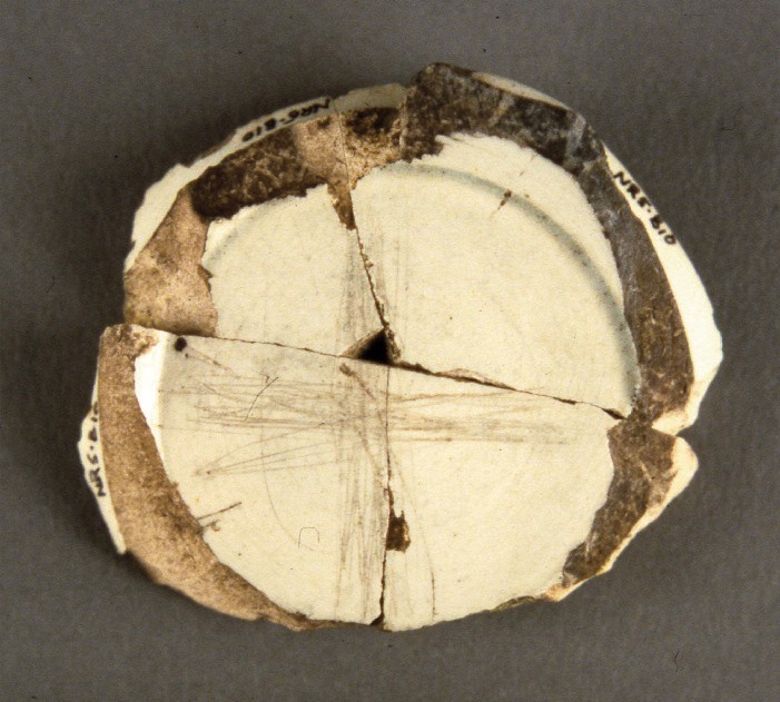
Base of a pearlware bowl recovered from the O’Brien site. (Photo, Daniel Finamore.) The bowl is inscribed with an “X.”